This hike is the second of many I’ll need to do to finish hiking the Onondaga Trail.
The Onondaga trail is part of the Finger Lakes Trail branch system.
If you haven’t read and looked at the photos from the first hike, you can by clicking this link.
On the last hike, Caden and I walked to Route 13 and then turned around to head back to the car.
For this hike, we didn’t start at Route 13 because there is no parking where this section of the trail crosses the road. At Fairbanks Road, there is ample parking. Even though the road does turn from asphalt to gravel, the surface is in good condition.
The Starting Point on the Onondaga Trail
The parking area is adjacent to a beautiful pond.

The first part of the trail crossed the dike that created the pond. Not the path is shown in the photo; instead, the trail is to the left—the trail towards Route 13 heads eastward.

If there is a dew, expect to get wet on your way into the woods. The dike is mostly weed and shrub covered.
Several deep holes and cuts in the dike are covered with walking boards. However, the weeds along the trail hide the edges of the boards, and it would be accessible to miss-step and fall into the hole.
Ask Caden; he did a couple of times, as all he wanted to do was get into the water!

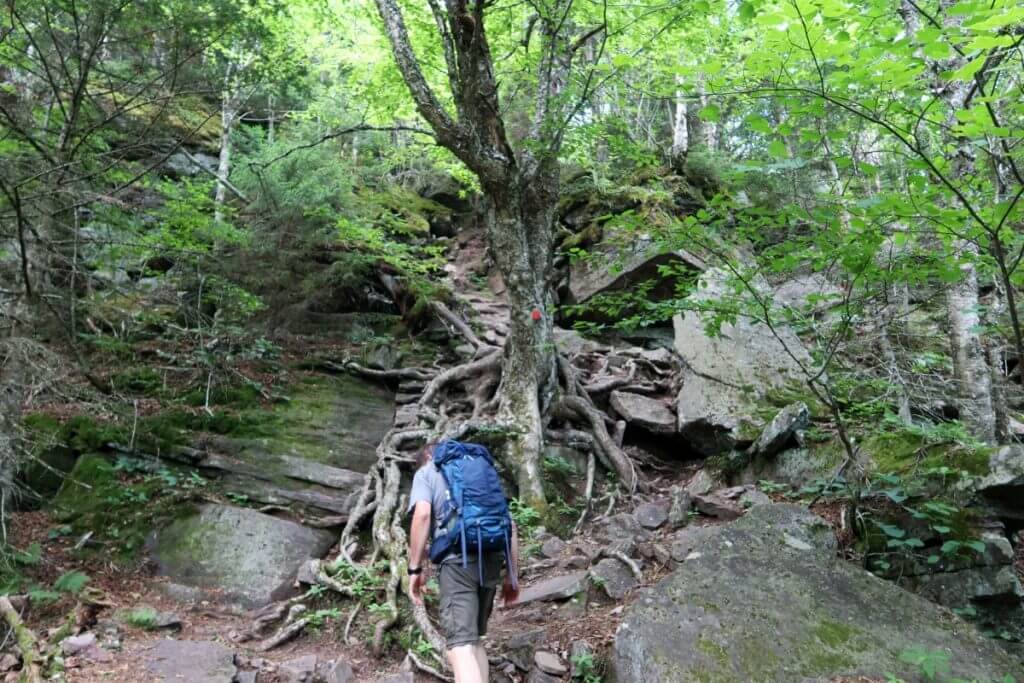
Onondaga Trail Section Surroundings
The trail goes through quite a diversity of surroundings. These include young open forests, mature hardwood forests, open sections that were once a ski hill (Mystic Mountain), a short walk on back roads and through a farm onto a farm lane, then on a path across a lawn section at the intersection of Route 13.
Before I include a gallery of photos showing the trail’s surroundings and conditions, I’d like to share some other photos and say some words about them.
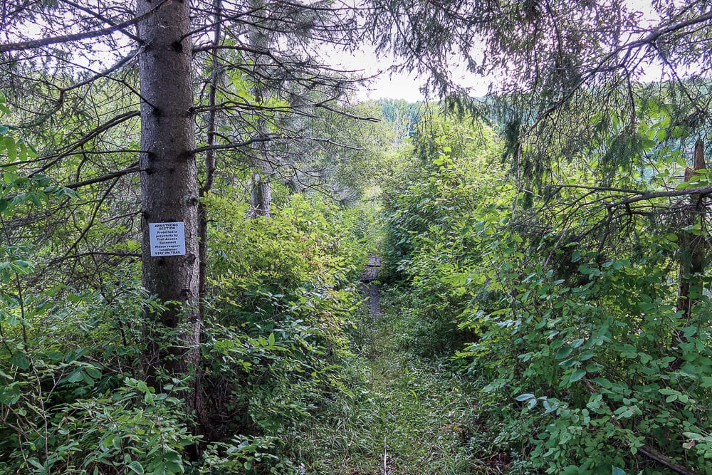
Onondaga Trail Perpetuity Easements
I’m not sure if people from the Finger Lakes Trail organization, those from the Onondaga Chapter of the ADK Mountain Club (they maintain the Onondaga Branch), or the land owner deeded a perpetual easement across some of the private properties.
But I would like to thank them for the forethought. Even though it’s evident that some of the new owners of the land (not in this case) are not happy with the easement, these easements connect the state lands, making the hike more enjoyable.
So please respect the trail, especially on the easement sections.

A Thanks to Landowners
Besides the trail easements, I appreciate the farmer (sorry, I didn’t get his name even though I talked to him) who lets the trail cross his fields and literally between his barns as well as the Hunt’s who let hikers use their lawn and placed bench near the intersection of Route 13.
You can see these in the galleries and Caden’s Adventure video below.
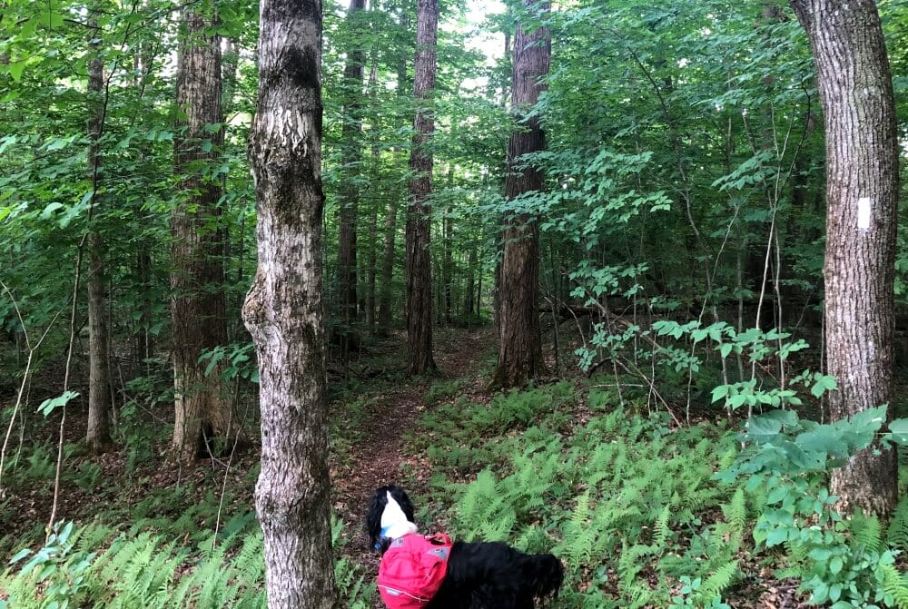
A Walk with Caden Dog
Onondaga Trail Section Description
Note: My trail description, route, and conditions are explained as seen on the day of my hike. These can and will change with the weather, seasons, time, and maintenance. The explanation is meant to give the reader some idea of what may be encountered, not necessarily as they may find it later.
Here is a synopsis of the trail. Below are some photo galleries of the trail conditions and terrain and some exciting things I saw on the hike.
For a map of the Onondaga Trail and the Finger Lakes Trail, visit this interactive map.
My View From The Woods is a participant in the Amazon Services LLC Associates Program, an affiliate advertising program designed to provide a means for sites to earn advertising fees by advertising and linking to Amazon.com. As an Amazon Associate, we earn from qualifying purchases. We may earn a small commission from the companies mentioned in this post at no additional cost. Not all links are connected to affiliate companies.
First Part of the Trail
The first part of the trail, as tracked by my GPS. You can click the image to have it expand for better viewing (all photos in this article are set up that way).

We started in the south at the parking area near a pond on Fairbanks Road.
The trail heads east across the pond dike and turns into a wooded section. You hike northeast along the shoulder of Kinney Hill, eventually reaching the nose of the north-south trending hill.
The trail turns north, still wooded, and becomes steeper, switch-backing down the woods to a ridge turning northwest.
You cross an old ski trail of what I believe was Mystic Mountain.
Second Part of the Section
As you approach Webber Road and the old lift building, the trail flattens out. Here you turn right and follow Webber Road turning right onto Parker Road and between a house and barn.

A short way down Parker Road, the trail turns east at the barn’s corner and follows a tractor lane. Eventually, the lane turns to the north until it crosses a small stream, then turns east.
Here the trail follows the stream (ditch?) and becomes mown as it approaches Route 13. The Hunt’s (at least that was on the mailbox of the house) have a bench placed on the grassy trail that served Caden and me an excellent place to eat lunch.
This whole section of the trail is flat.
Trail Stats
The section between Fairbanks Road and Route 13 is short at 2.3 miles (according to my GPS). Our round trip was 4.6 miles with about 800 feet of vertical gain.
However, when you return to the parking area, you can walk down Fairbanks Road with the trail and go westward on the Onondaga trail afterward – that is what we did.
Views of the Onondaga Trail
Below is a photo gallery of the hike and trail when I hiked it in September. You can click the photos to see the description.


Fairbanks Road to Route 13 Section Summary
Although short and relatively flat compared to other sections I hiked, this section is enjoyable.
The pond and walk along the dike were pretty, and the woods on Kinney Hill were open, providing lovely forest views. The trail is dry, although if you go early in the morning, expect dew on the dike and the field sections near Route 13.
I’m not a fan of field and lane walking, much less walking on roads, preferring the wooded sections. Even though this section had many of the former, I enjoyed the hike.
Especially the short steeper section with the switchbacks. The woods are open with larger trees with no undergrowth.
This section is about 2.3 miles long, so a total of 4.6 miles there and back with only 800 feet of elevation climb.
MVFTW Section Rating
I will rate this section of the Onondaga Trail as a 3.5. The good parts are excellent, but much of the section is flat, open, or a road hike.
If someone wanted the company to complete the Onondaga trail, I’d hike it again.
It would also be a good section for someone new to hiking, recovering from an injury, or breaking in new footwear.
I hope you got something from this article. In the future, there will be more videos for sure.
As new articles are published on the different trail systems, additional links will be added to help clarify how all of these sections fit into each trail system.
After all, this hike occurred on three trails—the Onondaga Branch of the Finger Lakes Trail system as well as on the North Country Trail.
If you have any questions or would like to use any of the photos, don’t hesitate to contact me, and I’ll get back to you.